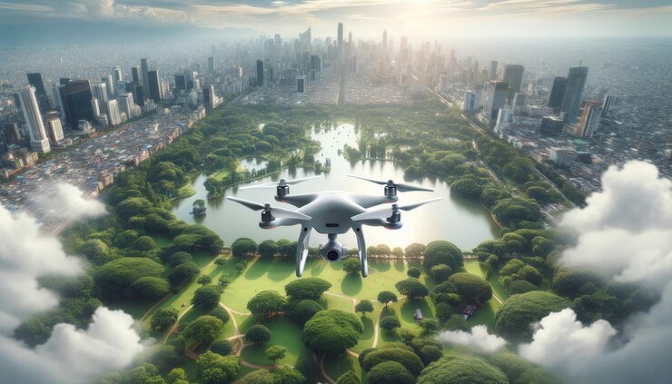
Autonomous drones are revolutionizing industries like logistics, agriculture, and disaster response, thanks to their ability to operate without direct human control.
Central to their functionality is artificial intelligence (AI), which enables them to navigate complex and dynamic environments with increasing efficiency and safety.
In urban areas, dense forests, and unpredictable disaster zones, traditional navigation methods fall short. AI empowers drones to overcome these challenges through advanced techniques that ensure reliable and safe operation.
This article explores how AI drives the navigation of autonomous drones in such environments, detailing the key technologies, algorithms, and real-world applications that showcase the potential of this transformative technology.
Role of AI in Drone Autonomy
AI plays a pivotal role in enabling drones to operate autonomously, especially in complex and dynamic environments. Here’s a closer look at how AI contributes to drone autonomy:
Real-Time Decision Making
AI algorithms empower drones to make real-time decisions based on their surroundings. By processing data from various sensors, AI systems can interpret the environment and make instantaneous adjustments to the drone’s flight path.
This capability is crucial for avoiding obstacles, responding to unexpected changes, and ensuring safe navigation.
Machine Learning and Deep Learning
Machine learning (ML) and deep learning (DL) are integral to improving the autonomous capabilities of drones. These AI approaches allow drones to learn from data and experience, enhancing their ability to recognize patterns, predict outcomes, and improve performance over time.
For instance, deep neural networks can be trained to recognize and classify objects in the drone’s path, enabling more sophisticated obstacle avoidance and navigation strategies.
Computer Vision
Computer vision, a field of AI focused on enabling machines to interpret and understand visual information from the world, is essential for drone autonomy.
By utilizing cameras and advanced image processing algorithms, drones can detect and identify objects, track movements, and understand spatial relationships.
This visual data is critical for tasks such as mapping environments, avoiding obstacles, and identifying landing zones.
Path Planning Algorithms
AI-driven path-planning algorithms are used to determine the most efficient and safe routes for drones. Techniques such as A* (A-star), Dijkstra’s algorithm, and Rapidly-exploring Random Trees (RRT) enable drones to calculate optimal paths, taking into account various constraints and potential hazards.
These algorithms are particularly useful in complex environments where the terrain and obstacles can change dynamically.
Simultaneous Localization and Mapping (SLAM)
SLAM is a technique that allows drones to build a map of an unknown environment while simultaneously keeping track of their location within that map.
AI enhances SLAM by integrating data from multiple sensors, such as cameras and LiDAR, to create accurate and real-time maps. This capability is vital for navigating uncharted or dynamically changing environments.
Obstacle Detection and Avoidance
AI algorithms for obstacle detection and avoidance are critical for safe drone operation. By using sensor fusion techniques, drones can combine data from multiple sources (e.g., cameras, LiDAR, ultrasonic sensors) to detect obstacles in their path.
Real-time processing allows drones to react swiftly to avoid collisions, even in complex and cluttered environments.
Reinforcement Learning for Adaptive Navigation
Reinforcement learning (RL) is a type of machine learning where drones learn to navigate by interacting with their environment and receiving feedback.
Through trial and error, RL algorithms enable drones to develop optimal navigation strategies that adapt to changing conditions.
This approach is particularly effective for dynamic environments where pre-programmed paths are insufficient.
Key AI Techniques for Navigation
Navigating complex environments poses significant challenges for autonomous drones, requiring advanced AI techniques to ensure safe and efficient operation. Here, we explore some of the key AI techniques employed in drone navigation:
1. Path Planning Algorithms
Path planning algorithms are essential for determining the optimal route for drones to navigate from one point to another while avoiding obstacles and minimizing travel time. Several algorithms are commonly used in drone navigation:
An Algorithm:* A heuristic search algorithm that finds the shortest path between two points on a graph, considering both the cost of reaching a node and the estimated cost to reach the goal.
Dijkstra’s Algorithm: An algorithm that calculates the shortest paths from a single source node to all other nodes in a graph, considering the distance between nodes.
Rapidly-exploring Random Trees (RRT): A probabilistic algorithm that rapidly explores the search space by randomly sampling new points and connecting them to the existing tree structure.
These algorithms enable drones to plan safe and efficient paths through complex environments, taking into account obstacles, terrain features, and other constraints.
2. Simultaneous Localization and Mapping (SLAM)
SLAM is a fundamental technique that enables drones to create maps of their surroundings while simultaneously determining their own position within those maps.
This is crucial for navigating unknown or dynamically changing environments where pre-existing maps are not available. SLAM algorithms combine data from various sensors, such as cameras, LiDAR, and inertial measurement units (IMUs), to build accurate and up-to-date maps that drones can use for navigation.
3. Obstacle Detection and Avoidance
Detecting and avoiding obstacles in real time is essential for safe drone navigation. AI techniques, such as computer vision and sensor fusion, are used to detect obstacles in the drone’s path and determine appropriate avoidance maneuvers.
Computer vision algorithms analyze visual data from onboard cameras to identify obstacles, while sensor fusion combines data from multiple sensors, such as LiDAR, ultrasonic sensors, and radar, to improve detection accuracy and reliability.
4. Reinforcement Learning for Adaptive Navigation
Reinforcement learning (RL) is a powerful AI technique that enables drones to learn optimal navigation strategies through trial and error. In RL, drones learn from their interactions with the environment, receiving rewards for desirable actions and penalties for undesirable ones.
Over time, RL algorithms enable drones to develop adaptive navigation policies that can handle a wide range of environmental conditions and obstacles.
5. Deep Learning for Perception
Deep learning techniques, such as convolutional neural networks (CNNs), are used to enhance the perception capabilities of drones. CNNs can process visual data from onboard cameras to detect objects, recognize landmarks, and classify terrain features.
By leveraging deep learning, drones can perceive their surroundings more accurately and make better-informed navigation decisions.
Case Studies and Real-world Applications
Examining real-world applications of autonomous drones provides invaluable insight into the practical benefits and capabilities of AI-driven navigation systems. Here are some compelling case studies showcasing the diverse applications of autonomous drones:
1. Urban Delivery Services
In densely populated urban areas, autonomous drones are being deployed for last-mile delivery of goods and packages.
Companies like Amazon Prime Air and Wing (a subsidiary of Alphabet) are leveraging AI-powered navigation systems to autonomously navigate through city streets, avoid obstacles, and deliver packages to customers’ doorsteps efficiently.
These drones are equipped with advanced sensors and AI algorithms that enable them to navigate complex urban environments safely and reliably.
2. Search and Rescue Missions
Autonomous drones equipped with AI-driven navigation systems are invaluable tools in search and rescue operations, particularly in remote or hazardous environments.
Drones can quickly survey large areas, identify survivors or hazards, and relay critical information to first responders.
For example, during natural disasters such as earthquakes or floods, drones equipped with thermal imaging cameras and AI algorithms can detect heat signatures from trapped individuals, guiding rescue teams to their location more effectively.
3. Agricultural Monitoring and Precision Farming
In agriculture, autonomous drones equipped with AI-enabled navigation systems are revolutionizing crop monitoring and management.
Drones equipped with multispectral cameras and AI algorithms can analyze crop health, detect pests and diseases, and optimize irrigation and fertilization schedules.
By autonomously flying over farmland and collecting data, drones enable farmers to make data-driven decisions that increase crop yields, reduce resource usage, and improve overall productivity.
4. Infrastructure Inspection
Autonomous drones are increasingly used for infrastructure inspection tasks, such as inspecting bridges, power lines, and pipelines.
Equipped with high-resolution cameras, LiDAR sensors, and AI-driven navigation systems, drones can autonomously navigate complex structures, identify defects or anomalies, and generate detailed inspection reports.
This reduces the need for manual inspections, improves safety for inspection personnel, and enables more frequent and comprehensive assessments of critical infrastructure.
5. Environmental Monitoring and Conservation
Autonomous drones play a crucial role in environmental monitoring and conservation efforts. Drones equipped with AI-powered navigation systems can survey vast and inaccessible areas, monitor wildlife populations, and track changes in ecosystems over time.
For example, conservation organizations use drones to monitor endangered species, combat poaching and illegal logging, and assess the impact of climate change on fragile ecosystems.
AI algorithms help analyze the vast amounts of data collected by drones, providing valuable insights for conservation planning and management.
Conclusion
Autonomous drones, powered by artificial intelligence, are reshaping industries and revolutionizing how we approach a wide range of tasks, from delivery services to search and rescue missions.
By leveraging advanced AI-driven navigation systems, these drones can navigate complex environments with precision and efficiency, opening up new possibilities for innovation and efficiency.
As we look to the future, the integration of AI into autonomous drone technology holds immense promise for addressing pressing challenges across various sectors.
From enhancing safety and productivity in urban delivery services to improving disaster response efforts and optimizing agricultural practices, the potential applications of AI-driven autonomous drones are vast and far-reaching.
With ongoing advancements in AI algorithms, sensor technology, and drone capabilities, we can expect to see continued growth and innovation in this rapidly evolving field, ultimately driving positive impacts on society and the economy.